
Introduction
Geography has profoundly shaped the historical trajectories of ancient civilisations, influencing patterns of trade and transportation through natural barriers, resources, and strategic locations. In the context of ancient India, particularly the Indus Valley Civilization (circa 2600–1900 BCE), geographical features such as rivers, mountains, and coastal access played defining roles in economic and cultural exchanges. This essay explores how geography impacted trade and transportation in the Indus Valley Civilization and broader ancient India. It examines the significance of river systems, the challenges posed by mountainous terrain, and the advantages of coastal proximity, drawing on historical evidence to argue that geography was both an enabler and a constraint for economic connectivity in these early societies.
River Systems as Economic Lifelines
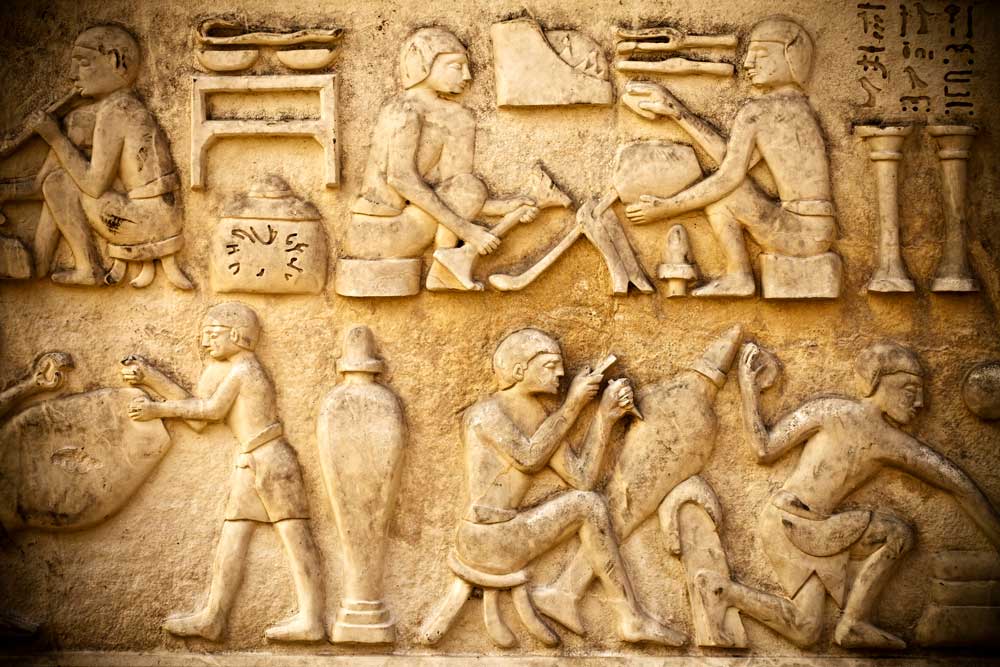
The Indus River, along with its tributaries, was central to the prosperity of the Indus Valley Civilization, providing a vital transportation network for goods and people. Cities such as Harappa and Mohenjo-Daro were strategically located near the river, facilitating the movement of agricultural surplus, raw materials like cotton, and crafted goods including pottery and beads. Archaeological evidence suggests that riverine transport, likely using simple boats, enabled internal trade between urban centres and rural hinterlands (Kenoyer, 1998). Furthermore, the annual flooding of the Indus enriched the surrounding plains, supporting surplus production that could be traded, thus acting as a catalyst for economic activity. In broader ancient India, the Ganges River similarly emerged as a crucial conduit for trade during later periods, linking regions and fostering cultural exchange. Indeed, rivers were not merely routes but also economic foundations, shaping settlement patterns and trade priorities.
Mountain Ranges as Barriers and Gateways
The Himalayan mountain range and the Hindu Kush in the northwest of ancient India presented significant obstacles to overland trade and transportation. These formidable barriers limited direct access to Central Asia, yet they also channelled trade through specific passes, such as the Khyber Pass, creating controlled gateways for interaction. This geographical constraint necessitated the development of caravan routes, where goods like lapis lazuli from Afghanistan were exchanged for Indus Valley products, as evidenced by artefacts found in Mesopotamian sites (Possehl, 2002). While the mountains hindered large-scale movement, they inadvertently fostered strategic trade hubs at their fringes, demonstrating how geography could both impede and indirectly structure economic networks. However, the isolation provided by these ranges also meant that certain regions developed distinct cultural identities, occasionally limiting broader integration.
Coastal Access and Maritime Trade
The proximity of the Indus Valley Civilization to the Arabian Sea enabled maritime trade, a critical dimension of its economy. Ports like Lothal, with its sophisticated dockyard, suggest that the civilisation engaged in long-distance trade with Mesopotamia, exchanging goods such as carnelian beads and timber for Mesopotamian metals (Rao, 1979). Coastal geography provided access to wider trade networks, bypassing the challenges of overland routes through mountainous terrain. In later ancient India, the long coastline along the Bay of Bengal and the Arabian Sea continued to support maritime commerce, connecting the subcontinent to Southeast Asia and the Middle East. This geographical advantage arguably positioned ancient India as a pivotal player in early global trade, highlighting how proximity to the sea could overcome inland limitations.
Conclusion
In conclusion, geography profoundly influenced trade and transportation in the Indus Valley Civilization and ancient India through river systems, mountain ranges, and coastal access. Rivers like the Indus served as economic lifelines, fostering internal connectivity, while mountains posed challenges yet shaped strategic trade routes. Coastal proximity enabled maritime links, expanding economic horizons. These geographical features collectively determined the possibilities and limitations of trade, illustrating that environment was a fundamental driver of historical development. The implications of this analysis suggest that understanding ancient economies requires a nuanced appreciation of their geographical contexts, as natural landscapes were integral to shaping human interactions and resource distribution in these early societies.
References
- Kenoyer, J. M. (1998) Ancient Cities of the Indus Valley Civilization. Oxford University Press.
- Possehl, G. L. (2002) The Indus Civilization: A Contemporary Perspective. AltaMira Press.
- Rao, S. R. (1979) Lothal and the Indus Civilization. Asia Publishing House.
